Eastern North America Tour Y2K
Day 24: Thoreau says, "We must learn to reawaken and keep ourselves awake, not by mechanical aids, but by an infinite expectation of the dawn, which does not forsake us in our soundest sleep." When I don't want to get up or need to get up, it's very easy for me to oversleep, but when I want to go, it's impossible for me to sleep too long. This morning, I had intended to leave early, and I am anxious to go, so as soon as the first light entered the room, I start waking up. I actually try going back to sleep, as I feel it was a bit too early, but my internal alarm clock won't quit ringing, so I am finally forced to get up.
The push today is that I am going to visit John Schubert, who I have had many computer conversations with. John says his wife Ann is anxious to meet me. Also, Wendy Strutin Riedy says she wishes to ride with me on the following day.
The bike was packed last night and is ready except for the laptop, as I wanted to check for email before leaving. I eat some bananas and check my messages, and pack the computer. By that time, my sister is up, and she opens the garage door to let the bike out and sees me off.
Not long after leaving her house, I stop a Wawa convenience store. Unlike the convenience stores I have been used to, this store has fresh bread, fruit, subs, and a huge variety. The name comes from Wawa, Ontario, the little town that I first visited by bicycle in 1966, which has everything. The store even uses the same goose. I get some fresh bread because I might not find it again today.
Leaving the store, I follow a road that parallels the main road, White Horse Pike, until it crosses it. Here I start traveling on the pike itself, which is a busy four-lane in spite of its being early Saturday morning. However, after passing the expressway, the four-lane becomes a two-lane with a wide shoulder, and traffic ceases to be a problem. Some miles on, I notice that my road is turning into expressway ahead, so I make a left turn and get back onto the original road, which leads me to the Ben Franklin Bridge.
There, I discover that the pedestrian walkway has been closed for four months, and the officer advises me to take the bus. While waiting, a bus passenger arrives and tells me that some of the buses can carry my bike below. The driver of the bus wants me to put my bike on the front rack, but I am afraid of the situation because of the weight on my bike. Then I wait half an hour for another bus, but the buses that come by with room for my bike underneath don't bother to stop. Finally, I decided to take the ferry across.
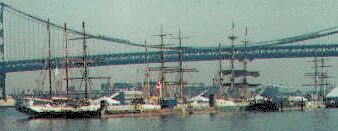
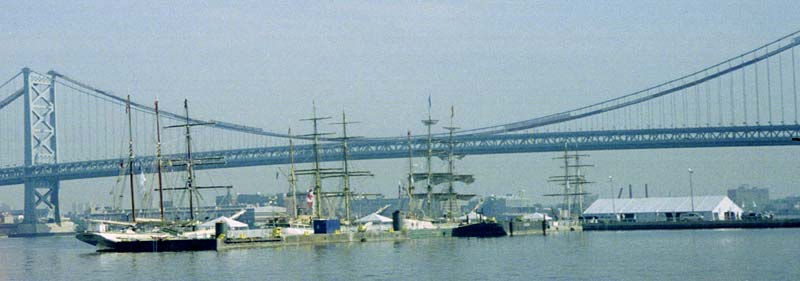
I have no problem with taking the ferry; indeed, that would have been my preference, but taking the ferry costs me nearly an extra hour and a half since it starts later, time that should be saved for a rest period later in the day. Now, I am going to have to pedal through my lunch break. The ferry leaves a little early and zips across the river smoothly and quickly; so quickly that it's a mistake for me to have locked my bike to the side (to prevent its falling over). It's the quickest ferry ride I've ever been on. On both sides of the river are sailing ships ( 630X329 Tall Ships). Yesterday a fleet of them arrived, with the sky full of helicopters and a Goodyear blimp, and the shores crowded with people. Today, people are going aboard the ships, but I just take some pictures of one, as I visited a similar wooden sailing ship during my 1995 trip on Lake Huron (unfortunately this photo was ruined by flair; my camera had some kind of light leak or something). 630X329 Tall Ships). Yesterday a fleet of them arrived, with the sky full of helicopters and a Goodyear blimp, and the shores crowded with people. Today, people are going aboard the ships, but I just take some pictures of one, as I visited a similar wooden sailing ship during my 1995 trip on Lake Huron (unfortunately this photo was ruined by flair; my camera had some kind of light leak or something).
I next cross Philadelphia on my bike. There are lots of people traveling by bicycle, but I notice that I am about the only one to wait for red lights. I arrive at Fairmont Park and follow the river parkway. Normally, when I am arriving in Philadelphia, I come in this way, but this road is too busy with afternoon traffic for bicycles, and bicycling is forbidden during those hours as well, but now the road is OK, and I quickly pass all the "cyclists" on the bikepath.
When I reach Ridge Road, I separate from my usual route in and out of Philadelphia. Here I am fortunate enough to meet a group of four cyclists who guide me for a short distance and then point out the route to follow. They are rather surprised that I climb the first steep hill by standing on the pedals rather than by gearing down. Actually, it's not that steep of a hill, and I could keep up with the leader better by not gearing down. They suggest taking Walnut Road until I reach Germantown Road. They warn me of the bricks and streetcar tracks on Germantown Road.
The ride to Germantown Road is delightful, with woods and bridges over deep valleys, some with roads passing underneath. However, Germantown Road is dreadful, as it is not a brick road but a cobblestone road and jars my bike terribly on the bounces. Sometimes a foot-wide strip outside the tracks is paved, but this puts me in conflict with a flood of motor traffic which can't pass me. In addition, in some places, parked cars line both sides, making being "doored" a real possibility. One of the cyclists had suggested that the "bricks" would end over the first hill; over the third hill, the cobbles do briefly end, but they are sidewalk to sidewalk after that. I stop, tired of the cobbles and no longer wishing to beat my bike to death. I ask a couple for directions, but she says they are new to the area. Shortly afterwards, a motorist stops to give me directions but does not recognize that I am traveling by bike. How did he know I need help? At any rate, he suggests I move over to Stenton Avenue, which is now a short distance away and which will run directly into Bethlehem Pike. I even find a good supermarket where I can get some fruit along the way.
Bethlehem Pike is a good road, as it has a nice shoulder (usually) and not too much traffic. I stop and phone John to tell him my progress, a call that costs $.75 and that suddenly cuts off at the end of three minutes. It's a good way to Lansdale yet, but before I get there, I have a premonition that my road is going to end, and a look at the computer map confirms the same, but the computer map is too difficult to read here. So, I stop at a gas station, and a customer gives me the correct directions in a few words, telling me how to get onto 63, which will take me to Lansdale. This leads me into Lansdale, and then on the other side (with the help of the computer), I get onto the Allentown Road for the rest of the trip.
The Allentown Road has less traffic than the Bethlehem Road, but it is hillier, and I am tiring out from riding in the heat of the day. Several times, I have to walk up hills, and finally, I feel my energy is about gone. I notice at some time that my rear rack has been swaying more than normal, but I don't have the energy to look at it. Then I reach the stop marked on John's map and am suddenly lost. A quarter of mile later, I pull off the road to compare my two maps, and two cyclists appear. The first identifies himself as John Schubert, so I assume the second is Ann. However, the second is Wendy. They guide me to John's house as I am so drained that I am almost sick; I don't think I could find my way back again from memory.
After we get some drinks, John tells an amusing tale. He had come to look for me when Wendy showed up and said, "You must be John Schubert." Well, his name was on a little plaque on the bike, so that was not too much of a shock, but then she said, "You must be looking for Ken." That blew him away, as he did not know anyone else knew I was coming. However, thinking about this story later, I recognize that it was even more astonishing because Wendy had no idea of when or by what road I would arrive, and she had traveled a long way from home.
While chatting, Wendy agrees to come by in the morning, and after Ann arrives and offers raspberry jam with champagne for breakfast, she agrees before leaving to arrive a little early. I notice that my rear rack has a broken top support; it has traveled about 53,000 miles. John barbecues some chicken, while Ann makes some great zucchini to go with it, we eat, have some conversation, and John takes me to the guest house, where I have trouble sleeping, so I read a book until I get too tired to remain awake.
Somerdale - Coopersville, Pa., 78 miles, 13.6 mph, June 24, 2000.
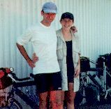
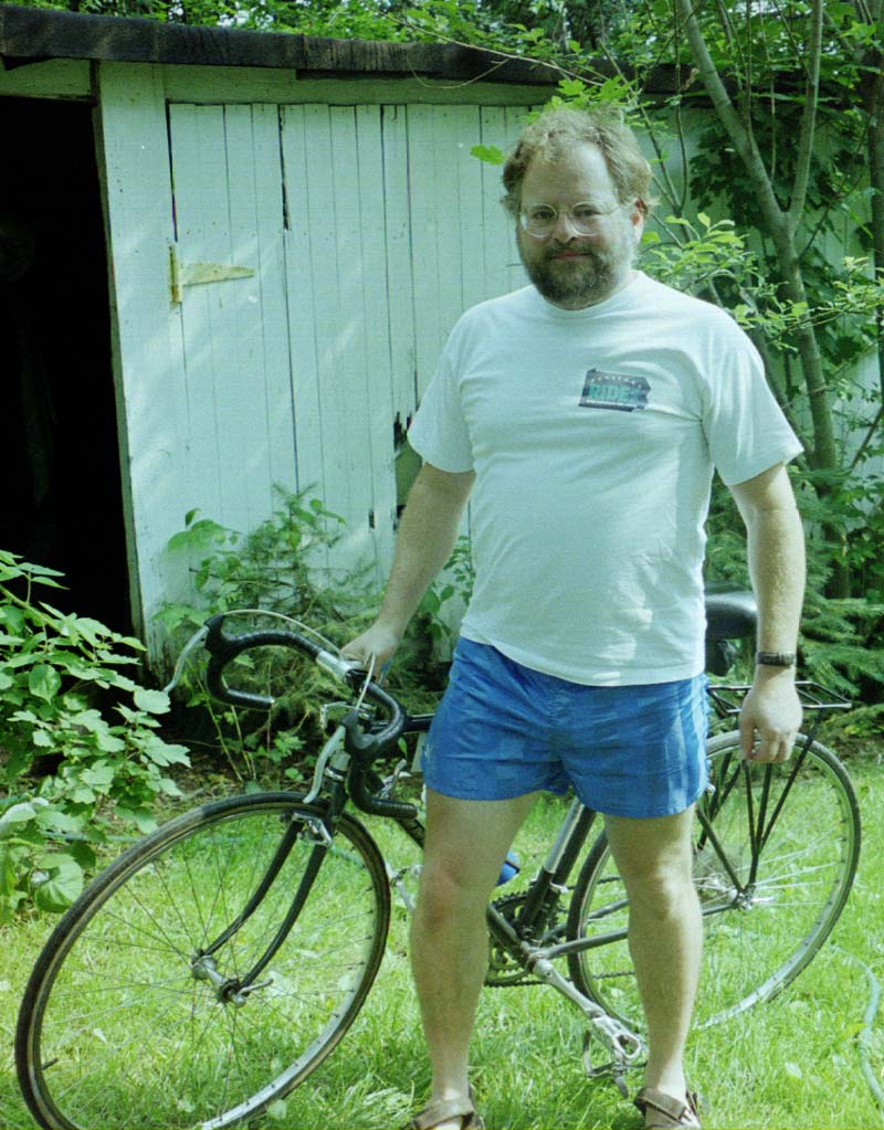
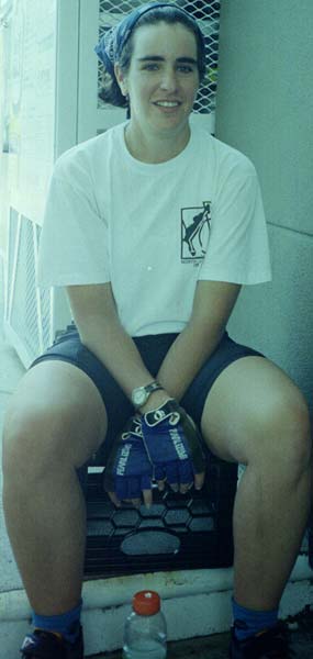
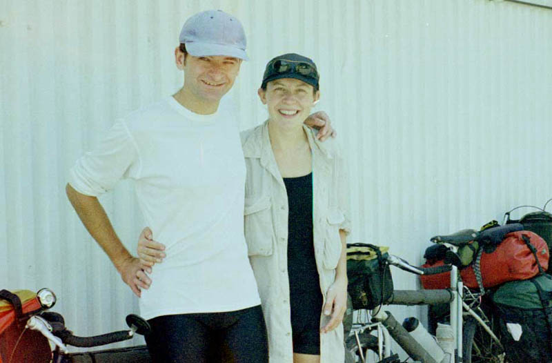
Day 25: I wake up a little late for me, but we agreed on breakfast at eight, so I have time to write my account. However, instead I read an Adventure Cycling magazine. Then, I see it's almost eight, and get ready to leave. Ann and I are the only ones up, but before long, John wakes up and Wendy arrives. I eat a little for breakfast, and Wendy doesn't want anything. We take the obligatory pictures (800X1023 John Schubert) and seem ready to roll, but a van arrives, bringing back John's son, and a woman with a long tale to tell. I finally break away and then John joins me and he suggests Wendy and we look at an old house before leaving. While walking there, we find an extremely tame male deer, so John and I go back for our cameras. We also tell some others, and a half dozen people spread out as they approach the deer. Of course, the deer bolts at this, but he doesn't run too far, and soon well over a dozen people are milling around, hoping for a better view. Then John finally shows us the house, and we get ready to leave.
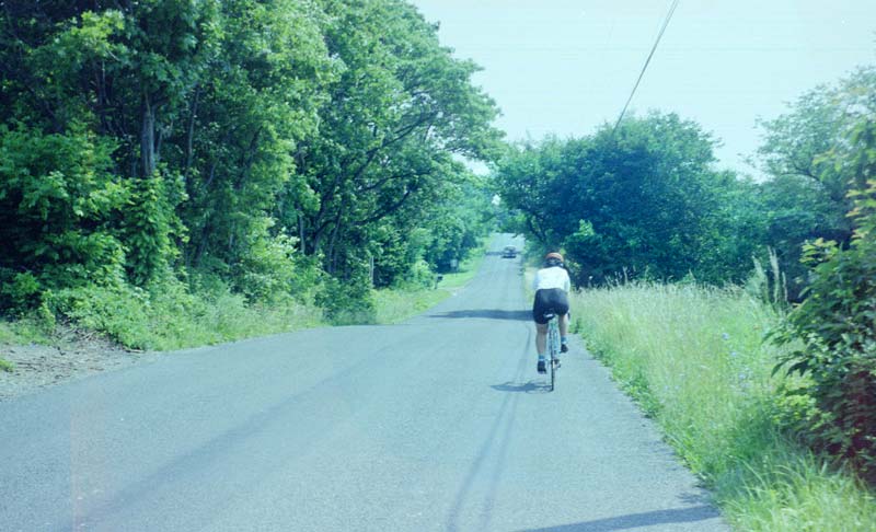
Wendy has charted a route that she says is mostly downhill, but she seems to be bothered by some of the uphills we encounter because she hasn't remember them. The situation reminds me of my mistakes under the same circumstances, especially at Mt. Mitchell in '96. But the downhills are long and fast while the uphills are no great sweat. It's easy to see some of the differences caused by a loaded tour bike: On the downhills, I am slow at first, but the bike builds momentum, and I am soon booming along and Wendy is in danger of being run down. So, I form the habit of passing her soon after starting down hill. I have the same type of advantage on the rolling terrain, as my bike has enough momentum to carry it up a grade rather quickly, at least at first. On the hills, however, Wendy has to slow down for me, and at one point, I have to stop for a long breather while she is still fresh.
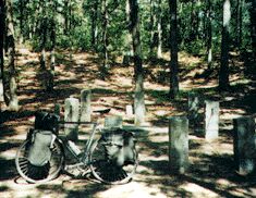
Wendy Riding Ahead

|
I get a couple of pictures of her as we are riding together, but getting it is more complicated than one would think. My old shorts had pockets on both sides, but I had only enough pockets from them to sew one on the left side of my new shorts (the left side because I am left-handed). The camera, on the other hand, is right-handed, so I must pull it out of my pocket, hold it in my teeth by the strap while I swap hands on the handlebars, then take a one-handed picture with the wrong hand (for me, not for the camera), then put the strap back in my mouth, swap hands, and finally get the camera back in my pocket. To add to the difficulty, I am pedaling and steering the bike up and down hill while being passed by cars at close distance (800X486 Riding Behind Wendy).
After 16 odd miles, our little trip is over. We stop for drinks (sports drinks, of course) before separating (285X600 Wendy). Wendy shows me on the map the route we had followed, a route that involved traveling on an unmarked road over to 212, and then taking 212 down to 611.
I now have a trip of about ten miles to Easton, where I can get a replacement for my rack. This trip is along the Delaware River, the same route that I followed traveling the opposite direction in 1993. Then I was traveling with a cyclist determined to put on the miles, which led to my traveling over 100 miles in one day. Today, the weather is very hot, we started quite late due to the deer, etc., I am still not recovered from traveling in the full heat of the day before, and I have had very little to eat.
So, I stop again on my way to Easton to eat, and I feel my energy ebbing as I go. I also find a white mulberry tree and have a feast there. Sunday is a good day to be making this ride, as the road is rather narrow and often busy with traffic. On the river side is the Delaware Canal, which has been restored to use. However, no canoes are using it, in spite of the many in the river beyond. There is a bike path along the canal, one of those mountain bike affairs which is of no value to me. It would be a lovely ride if not for the heat, and I manage to enjoy it. However, I arrive in Easton with little energy left, so that I ask directions three times within two blocks, feeling I've traveled a long distance.
Getting a new rack from the store is easy, but mounting it is a real pain. This Blackburn rack is supposed to fit any bike, but the supports are much, much too long and not placed nearly wide enough for my bike. Fortunately, they are made of that wonderful bike strap material that allows for infinite bending, and I finally get them bent and forced into place. Then I go back to a Wawa and order a sub, which is my first real meal of the day. The time is four o'clock, central time, five local.
After Easton, 611 first stays along the river, and I soak my shirt to cope with the heat. Then it climbs away from the river and rolls up and down hills, and these climbs are not what I need. At one point, when turning and while walking, I discover a new, two CD album. I see some boys in front of a church, so I go down and offer them the CD, and one gets me some cold water to refill my bottles.
The sky gets black from an approaching storm, but there is no possible camping up here in farm country, and the narrow valley is also going to provide few opportunities. I come down off of the mountain having not seen anything that looks nice and roll into town. I ask at a gas station, and she tells me of a campground four miles in the wrong direction, but then suggests that I might be able to sleep behind the buildings. A check with the property owner and the policeman gets the nod, and so I put up my tent as the rain begins. It continues to rain fairly hard for most of the night. In the tent, I don't try to work with the laptop, as puddles of water are forming on either side and in the rear. However, I stay dry without problem.
Coopersville - Portland, 49.8 miles, 12.2 mph, June 25, 2000.
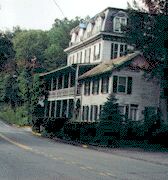
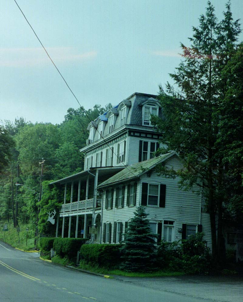
Day 26: In the morning, I first walk around to the store to get an orange juice and some donuts. Then I walk out over the river on the bridge. Then I go back and pack. The last time I went through the Delaware Water Gap, I was with a cyclist who wouldn't slow down, but this time I take my time. However, go as slow as I can, the gap does not last long, as it's only a few miles. Nonetheless, I stop and look at every point, including a "cave" that produces lots of cold air. I take some pictures, but it's really too foggy to expect them to turn out. When I go through the town, I stop and talk to several through-hikers, and I take a picture of the hotel where perhaps my grandparents stayed 100 years ago on their honeymoon. Notice how the building is right out into the road, common in Pennsylvania, and something I've never seen anywhere else. Some houses are so close to the road that a car would hit an open door.
On the other side of town, I get water and use the restroom at the info center, and I receive directions for the River Road. When I was riding through here with him on my 1993 trip, Mark had been so impatient to keep moving that he had missed our turn-off, and we had had to fight heavy traffic and even found ourselves going onto the interstate by accident. Now I take the road we should have taken, a ten mile journey through some very nice woods along with some fields. After I rejoin the main road, I stop at the visitor's center to find that camping is not allowed except for boaters and Appalachian Trail users. The woman who helps me also explains that I could have crossed the Delaware on the same bridge as the Appalachian Trail users to ride on the New Jersey side, which is more scenic and has less traffic. At the next store, I get a fairly expensive sub for lunch, but it's a good thing, as that is all I'll eat today beyond my donuts this morning and drinks.
Although the ride is pretty, the traffic is heavy, so I decide to cross over to New Jersey at Dingman's Bridge. I also intend to stop at some picnic table there, but not seeing an opportunity, I find a pleasant spot of woods. There I nap and type for nearly three hours.
At the bridge, there is a toll and a sign for bicyclists to stop, but the toll gatherer, who collects in both directions, waves me on. It's a wooden bridge across the Delaware, not very wide. The first part of the New Jersey side is wooded and very nice, with almost no traffic. Along the way, I find a few raspberries to eat, but not many. I also look for the youth hostel marked on the map, but when I get there, I find a wire to block traffic.
After reaching a road intersection, I travel on the second section of the New Jersey side. Here it's houses all the way, although traffic is light. I enter New York without any state sign present and immediately encounter a traffic jam between two entrances/exits of an interstate. However, I get my water bottles filled, so I am prepared now to camp. Leaving there, I begin to climb a hill. The sky is clouding up rapidly, and the threat of a storm is strong, plus it's late, and I have a long stretch of woods with no houses and no posted signs, so I pull off into the woods.
This woods is very rocky, so I have to hunt for a spot with some soft soil to set the tent on. Usually, an old roadbed has the hardest soil, but here the wisp of road has been overgrown for years, and the leaves and soil have washed onto it, so a bend becomes my camping site. Here, all the trees are small; I guess this mountain was stripped of its forest sometime before I was born and has grown back up in post oaks.
Portland - Port Jervis, NY, 49.5 miles, 10.9 mph, June 26, 2000.
Day 27: I sleep in late this morning, perhaps because I woke during the night and spent some time typing. I feel quite rested as I get up, my fatigue from previous days not noticeable. Just on the other side of the mountain, I find a good store with fresh bread products, made that morning. I get a huge cinnamon bun and two bagels. While I'm eating inside, the customers begin a discussion about someone riding a bicycle somewhere, but no one asks me what I am doing. During the day, I have almost no problems with cars due to the shoulders on the roads and due to the drivers usually being careful and polite when passing. I am traveling on Bike Route 17, but that has nothing to do with the shoulders or the politeness. I go through a construction area, and I ride for a short time with Dave, who has caught up to me on his bike before having to turn around.
However, I make an important mistake early on. As I am approaching Littleton, I come to a fork in the road, with 17m going the one way and 6 going the other. The map shows 17m going both ways. However, it shows the four-lane going into Littleton, so I turn right, not realizing that I am at an almost invisible intersection on the map. I am then surprised when I pass through Littleton without seeing any stores. Bike Route 17 makes a jog to the right. I travel on down to Goshen, where I find myself routed onto the interstate, which I immediately exit from and encounter Bike Route 17 again. But here the route turns north on 207. I look at the map, but it's not making any sense at all, and I can't ask at this store, where I've bought a Subway, as the fellows running it speaks little English, so I dig out the computer which is extremely hard to read in this bright light, and it seems to tell me to follow 17m, which parallels the interstate, so that is the route I follow. Actually, I have turned southeast, and I will have to ride extra miles to make up for this mistake.
For what it's worth, 17m is a good road to follow. It parallels the interstate, with light traffic and usually good shoulders. It's a fairly scenic route, even passing through a forest, but it also passes through several towns. However, the sense that something is wrong keeps growing on me, as these towns are not on the map. Finally, I stop and ask a lady, as I have seen no one for ten miles to ask. She immediately recognizes my error and tells me where to turn, unfortunately another mile or so in the wrong direction. I ride down there and turn on 32 north, so I am once again headed towards the bridge; however, I have spent half the morning without making any progress, and this new road has heavier traffic.
At noon, I am hot and tired, so I decide to look for a library. It's a good decision, as soon after I stop, a violent and unexpected storm hits, carrying away branches while I move my bike down underneath the library. I then pass almost three hours reading nothing of importance.
Leaving the library after the rain has stopped, I find cool weather, and only the fairly heavy traffic and the sometimes narrow shoulders cause me any problem. Some hills need a triple, but none need to be walked, and I am often traveling at over 25 mph. In Newburg, I start having trouble with my directions. Someone told me to turn right on Broad, and two people there say the same, but the road seems to dead-end at the river, so I take a left onto a narrow street. Most of the people in this run-down area are non-natives, and the rest I see are Black children and teenagers. I find that teenagers generally
aren't old enough to give good directions so I don't ask anyone. I run into torn-up streets, one-way streets, and streets full of teenagers, all while traveling through slums, so I'm not happy. Finally, I see two people at a house and stop to ask them. He is uncertain and asks her, and she is certain; however, he is unsure if she is right and asks her more questions and finally gives me very clear directions much different from hers that happen to be exactly right. They included using a road with a "road closed" sign, which would have stopped me. However, at the turn, I see my Bike Route 17 sign.
The bicycle/pedestrian walkway is approached from under the bridge, and it is cantilevered onto the side of the bridge. It gives a great view of the Hudson, but it is scary to me because it is unsupported; I would feel safer on the concrete highway shoulder a short distance away, and I would have a much quicker trip too. The floor is metal sheeting, which would be slippery when wet. However, it's a huge improvement over no route for bikes at all, and it is actually bicycle-able.
On the other side, I head down to Beacon, but take the first left, as I assume it's a shortcut. This time, I am correct, and I soon link up with 52. My bladder has been bursting for some time, but I can find no quick-stop or gas station with a john. Going over a hill, I see a nice little woods that would be excellent for camping if not so near houses and the road. However, it makes a good bladder stop. Of course, the very next gas station I pass has a john. Although the traffic is heavy, I don't have much trouble due to a narrow shoulder and cooperating motorists. I think the New York motorists have been the nicest so far; in fact, many have given me the thumbs up sign today. At Fishkill, I stop in a supermarket for some food, and when I come out, I recognize that my day is nearly over. It has been overcast all afternoon due to the earlier storm, and I won't be able to ride as late as a result.
Just up the road is a fork, with 82 to the left and 52 to the right. Although I need to take 82, I deliberately take 52, as I notice the mountain is very near. I cross over Fishkill Creek and soon am riding alongside some very nice woods. So I stop, find a place to push my bike up the embankment, and wait for a period with no cars in sight. When it arrives, I start up the slope, but my feet slide out from under me. The same thing happens twice more. Then I rest, almost hidden in the brush, wait until some cars pass, and climb past the bike and then pull it up. The forest floor is littered with sticks, and I keep getting them caught in the spokes or between the spokes and the derailleur. Of course, I could easily damage the bike this way, so I stop each time I find resistance. The mosquitoes are bad, so I spray myself. Then I push the bike well away from the road. It's hard selecting a camping spot, as the soil digests its leaves easily here, so there's no thick leaf cover, and there are lots of sticks and small stones. I finally decide, and evidently make a good decision, as sleeping comes easy and very quick.
Port Jervis - Fishkill, 62.4 miles, 12 mph, June 27, 2000.
Day 28: I awaken in the very early twilight and decided to write a little, as I was too tired to get started the night before. Before I finish the day's account, I get the itch to get going, so I get up and get ready to go. I don't even want to take time to eat, so I just eat an banana. I push the bike out to the road, watching for sticks in the spokes and being extra careful on the slippery slope. A cyclist comes riding up the hill just before I start riding. I ride to the bottom of the hill, where I buy a fountain drink, which will allow me to suck and ride. Five miles up 82, I find a supermarket, where I get some bananas and turkey sausage. With half of the sausage, I eat some of yesterday's bread that I intended to eat last night before going to bed. Then I get riding again.
Highway 82 is an easy road for a long distance, but gradually gets steeper on the hills. I stop at another store for a V-8, and a young, rather small woman is waiting on the steps. I get my V-8 and drink it, and stop to put on my sunscreen. Suddenly, I see the same young woman on her bike heading down the road I'm going to take, moving very fast. Was she worried about being on the road with me? At any rate, I overtake her before she reaches the top of the hill, and I announce that I am going to pass. On the way down the hill, I don't look back because I don't want her to think I've taken any special interest in her. I do wish that I could be as friendly with the women cyclists I meet as I am with the men.
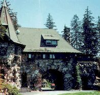
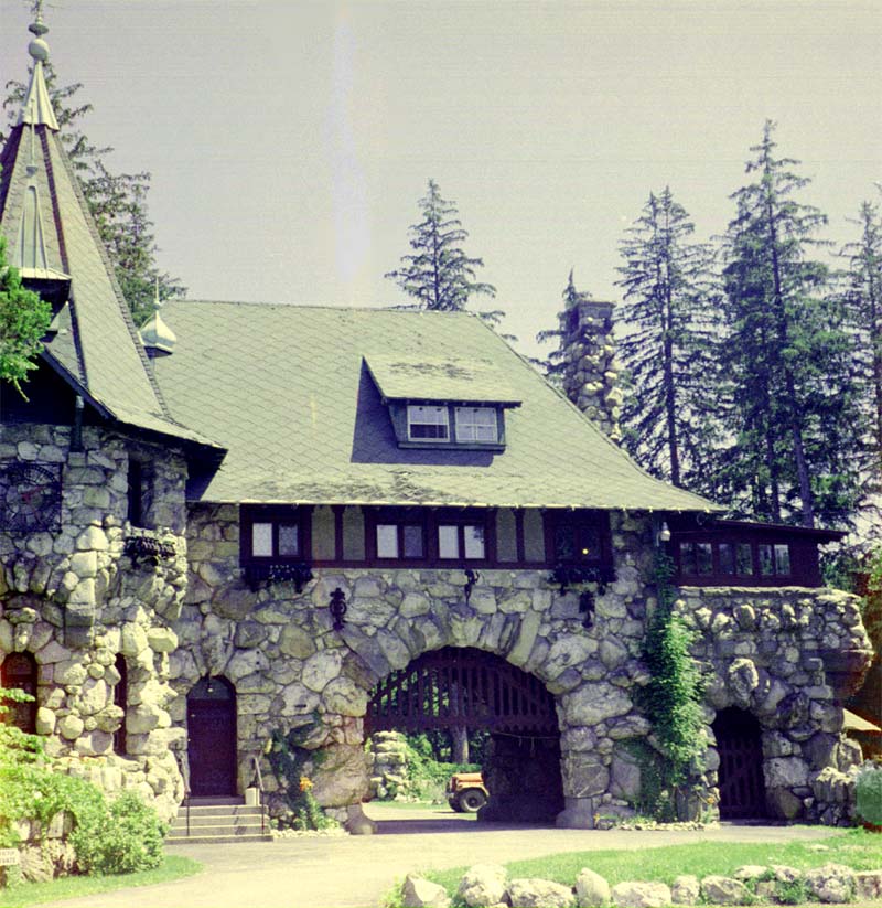
At Millbrook, a man tells me to make my turn at a stone wall or something, and a woman says her grandfather helped build it. The man says he doesn't understand how the stones were put in place. When I reach the turn, I see some interesting stonework but nothing to rave about. However, at the next turn, I see the strangest house I have ever seen, surrounded by "no trespassing" and "keep out" signs. The house looks like something out of a fairy tale, made of huge blocks of irregular rock and having a huge, unnecessary arch in the middle. This has to be what they were talking about. The road keeps getting hillier on the way to Amenia.
There, I see a Subway and decide to stop, but lo and behold, two bikes like mine are on the opposite side of the road. Odile and Herve, a French couple, are on a round-the-world trip and have just stopped for a rest. Since I am going to eat at one place and they at another, we separate for lunch, but we wave good-bye as we leave town in opposite directions.
A few more miles takes me across the state border into Connecticut, and there I stop in the park in Sharon and immediately fall asleep. When I awake, after half an hour, I go down to the library, but it is closed, so I write on the grass in front. I also eat my lunch. When it's time to get going, I am irritated to find no place to pee or to get water. I finally have to ride half a mile out of my way in order to buy water before going farther.
I was pleased with my morning's progress, but the afternoon brings one steep grade after another as I follow Highway 4 east. Part of this route is in a book of bike routes in Connecticut, so I don't think it's atypical. And the route is mostly through woods and forests; would I prefer flat farm lands instead? Nonetheless, the amount of walking I do tires me greatly, and this ends up a low mileage day. I cross the Housatonic River at Cornwall Bridge and then I have a steep climb along a stream. I pass by a town mostly hidden among the shrubbery and wetlands (Cornwall) and then begin an even steeper climb, walking the whole distance.
On most of this climb, there is no place to get off of the road, but near the top, I see a faint road overgrown with ferns. This road makes an immediate twist into a nice small camping area. It's somewhat within view from the road, but I can't get back further due to a deep small, artificial ditch, which I christen a mosquito ditch, as that's what it's good for breeding. Still, if I keep my head down, I'm not noticeable. I pitch my tent, and as soon as I am done, a light rain begins.
Fishkill - Mohawk Forest, Conn., 52.5 miles, 11.2 mph, June 28, 2000.
Day 29: In the morning, I travel a very short distance and find myself at Mohawk State Park, with no overnight use allowed and tons of rules. It's the first park which I've seen which forbids even changing clothes except in designated areas. However, the fine for the various horrible offenses seems to be $35.
It's then a very fast ride down to Goshen, with one long downhill after another. The ride into Torrington goes pretty fast too; however, the streets in Torrington seem to be all broken up. A mailman tells me I have to go "two miles" north if I want to find a variety of food. I am thinking of going straight ahead, but then I remember that I will be taking 202, which turns north, so I head north as was suggested. Unfortunately, the supermarket is a real disappointment, with expensive bread of uncertain date, so I just get some bananas and some poor-tasting yogurt.
On up the road, I ask for directions, and I'm told to turn at the light at Kennedy. I come to a light, but it looks like a freeway entrance and not a street, so I continue riding. A mile up the road, I recognize that I missed my turn. I'm about to go back when a cyclist shows up, and he tells me that my present route is an improvement because it will avoid a major hill. So I continue north to Winsted, where I stop to eat at a sandwich shop. While eating, I count out my American Express checks and discover that I've spent about $700 out of $2,200, or about a third of my money, having gone less than 1/4 of the distance. However, I also tally up the unusual expenses: two motels and a hostel, leg warmers, seat, rack, rear cogs, three ferry rides, and film development; these come to about $290. Thus while my daily expenses are high, they are not terribly high, about $13 a day, while I had allowed for $15. I won't be in trouble if I go over my expenses, but I don't want to.
Leaving Winsted, I take 44, then 318, and then 219. This is by no means a flat route, although I do see lots of woods. Then I have some easier travel on into Granby. Place names are funny in Connecticut, as there are also West, East, and North Granby's, all widely separate and independent towns [I have been corrected on this, as these towns are politically connected; however, the point is still generally true]. At the supermarket, I find I can use the internet, and I discover some important messages, which I can't answer there. So after eating some sourdough bread and chicken, I go back to the library where I am able to use the internet (after waiting patiently), the toilet (second time today!), and get water (first time since my purchased water yesterday).
Approaching East Granby, I encountered heavy traffic, and it's much worse as I leave and head down to the Windsor Locks. I soon find myself on a limited access road, so I pull off and use the computer map to guide me, as the paper map is useless here. A short distance on the other side, I stop at the trolley museum, but it's closing time and the only people I see are at a distance, evidently closing everything up. The cars I see seem to be in bad shape, but they are being operated along the track.
The hills in this area are steep and get steepest at the top, which usually includes a traffic light, so I find myself getting into trouble on these intersections, no matter what I do, as the traffic is also heavy. I follow 140 down to Ellington and over to Crystal Lake, but I find nowhere to camp along the way. People have built homes all throughout the wooded sections, and I don't want to camp next to or across from someone's house. I find a road and follow it, and it takes me to an unfinished house site, but there's no good camping place, and only one route in and out.
At Crystal Lake I feel exhausted, and it's getting too dark to ride. I want to ask at the fire-station, but the only people there are working on repacking a truck (an accident?). I stop and get a drink at the liquor store, the only place open, and the owner comes out to talk with me, so I tell him I don't know where I'll camp. He tells me that just across from the lake is 360 acres with lots of "paths" going into it, where I can camp. I probably would have passed it if I hadn't gotten his advice as all I can see when I get there is a couple of dirt roads going back into the woods. However, back in a distance is a hillside, so I pitch my tent up there, above the road below.
After I pitch my tent, I hear dogs barking from a house to the left, and I wonder if I'm too close, and soon after, I hear kids following the road on my right and a little later, I hear a truck going the same way, and then coming back out [in the morning, I will see that I am a long distance from any house].
Mohawk Forest - Crystal Lake, 64.8 miles, 11.7 mph, June 29, 2000.
Day 30: In the morning, I bicycle a fairly easy five miles to Stafford Springs, where I get something to eat. Then I take 190, heading toward Union. After another five miles, I find myself quite spent, and I have to rest for an hour, it being late in the morning already. The problem is too many steep, exhausting hills.
However, travel becomes less difficult. One advantage to traveling this route is that I'm traveling mainly through woods, although there are a lot of houses and a fair bit of traffic. One puzzle is where people get food and gasoline, as I don't see any gas stations or convenience stores, not even in the towns, such as Union and North Woodstock.
After passing North Woodstock and heading south, down toward Putnam, the ride really becomes easy. At Putnam, I find some stores and buy yogurt and a sub. Also at Putnam while resting at a bench in front of Wal-Mart, of all places, a woman sits next to me and tells about riding her bike from Putnam to Woonsocket without changing gears.
The ride now becomes very easy, except for the bad roads. I ride into Rhode Island and then turn north to Pascog. I travel through this crowded little town into Harrisville and then on up 98. Near the state line, I talk to a cement truck operator who tells me that I'm about to leave the woods. But while I pass a couple of likely spots, I don't stop (is the heavy traffic spooking me?).
Then, I pass under the interstate and head to Uxbridge. There's a park there where I can camp, I think. But after finding the unmarked park, which is basically a canal path, I am in doubt and look at my map again; no, camping is not allowed. So I continue on 16, with the traffic extremely heavy. People are going to several places to eat that are packed with cars and people and also to similarly packed drive-ins. I ride into Hopedale and ask at the police station there, but I am just told that the next town has motels.
At Milford, I get in a conversation with some younger people, who talk to me at first from their window; but they can offer no resting place, as their rooms are rented. They tell me a police station is just a short distance, so I walk there through the twilight to talk to two off-duty officers, who tell me I have two options: stay in a $49 motel or stay in a place for the homeless (with clean sheets). I do not like either option but choose the former. However, when I reach the motel, a large sign says, "Prices are from $74.95 and up."
I am most definitely not willing to spend $75 plus tax, so I cross under the interstate to immediately find a camping place just on the other side. Someone has been riding a four-wheeler into the woods right next to a for sale sign. I follow the trail upwards into the woods, and there is a path leading towards the interstate. I follow it to the top of the rise, and there is an area that looks as if it was used for camping at one time. I am too high above the traffic below for anyone to notice me, and I have some woods and weeds between me and the interstate. I don't have to worry about flashing a light as there are lots of flashing lights from the converging roads. However, I decide not to pitch a tent. First, there are no mosquitoes, second, there is little chance for rain, and third, I want to be up and going at first light because I am still awfully close to a large town. Besides, I am probably still somewhat spooked.
Crystal Lake - Milford, Mass., 72.3 miles, 10.9 mph, June 30, 2000.
Day 31: I awake very early as I expected. I didn't sleep as well, not being in a tent and woke several times in the night. I am still groggy, however, so I decide to write up my account before leaving. That is not to be. Although the mosquitoes barely bothered me during the night, they begin to attack me now, so I decide it's best to leave.
Mosquitoes are not all alike, some attack all night long, some only at dawn and dusk, and some will attack any time, day or night. These were probably of the dawn and dusk persuasion, and I had arrived too late the night before for them to bother me. Recognizing the different behaviors of types of mosquitoes can make a lot of difference camping outdoors.
So, I quickly pack and leave, starting on the road extra early. The morning's ride is fairly easy too. I intended to follow 126 all the way to Walden Pond, going through Framingham, but there's a detour on that road, so I continue on 27 into Natick and Wayland. Along the way, I pass lots of cyclists, joggers, and walkers. I also note houses built in the woods, as I had seen back in Connecticut, and I notice that a sidewalk has carefully been kept open, winding from yard to yard and up and down, with all hedges carefully trimmed along it, a clear sign that the sidewalk is being used and is regarded as important. In Alabama, such a sidewalk wouldn't exist, as people don't walk.
I make such good progress due to encountering only moderate climbs that I am passing Walden Pond before I recognize it. Only seeing the mock-up of Thoreau's 10 X 15 house snaps me to attention. I pass all the park stuff and stop at the path that leads to his house site. Although the sign says "no bicycles," I assume it means "no bicycling," and I push my bike into the woods. By error, I turn towards the lake, but my mistake teaches me a lot, as the side of the lake is no longer bare of vegetation but has been protected by temporary fencing. There's no sign of anyone bathing here now.
However, back at the site of Thoreau's hut, things don't look as good as they did seven years ago. Then the ground was covered with leaves, and the site seemed rarely visited. In fact, I saw few people visiting the site on my earlier trip. Now it looks as if heavy traffic has been going right up to the site, such as four-wheelers, and the leaves have been pulverized to dust.
Now that I can, I decide to sit there and work on my laptop. However, in half an hour, several groups arrive to see the site, and I decide that my bike and laptop are spoiling other people's moods, so I quit working. I ask and I discover that most have come from other states and countries to visit the site. It's true that they might be visiting all the historical sites in Concord, not just this one, but several indicate a strong interest in Thoreau. Perhaps on the three days of my previous trip, I just had been unlucky, but I think more likely that more are visiting the site now, perhaps due to the park encouraging them to do so, perhaps due to a growing interest in Thoreau.
Before leaving, I go down to the lake and take my bath. This time I am rewarded with everyone leaving me alone, so I can enjoy my thoughts. Thoreau considered the waters of Walden to be holy, like the waters of the Ganges, and I feel they are special too.
Then I ride into town for food, and to go to the library. The food trip works out well, as I get fresh bread and cooked chicken at reasonable cost, but the library is closed due to the approaching 4th of July. I talk to some people with an enormous dog, and then I go to the laundry to wash my clothes. Unfortunately, once again there is no place to change. A fellow washing his clothes tells me that there are no public bathrooms in Concord; one must use the restrooms in the restaurants, and he tells me the only water fountain is near the Mill Dam (downtown Concord). After washing the clothes I'm not wearing, I ride down to get some water, and then I head out to the pond again; however, I stop in the woods along the way because 1) I want to explore them a little and 2) because Walden Woods are too full of people, and I desperately have to find a place to relieve myself. I find a small pond here I never remember Thoreau mentioning, and a high rise of ground that matches one of his descriptions.
When I finally reach Walden Woods, I push my bike in a short ways to an isolated area, lay down and read what Thoreau says about the pond, and then take a nap. When the nap is over, I lock the bike up and walk down to Thoreau's house site, because I don't wish to disturb anyone, and I find more Thoreau admirers and also more bathers. I decide to walk around most of the pond to see what it is like. There's a path along the edge of the pond that has been there since before Thoreau's time, although it is wider now. The sides of the pond are definitely "walled in" as Thoreau reports, and the vegetation is coming back due to the fences. From time to time, natural stairways descending to the lake allow one to reach the water's edge, and each of these is full of people, the closing of "beaches" having forced people to spread out more.
Two features that Thoreau never mentions are most surprising about the pond. One is the steep rises and drops, along with the unpredictable nature of the terrain. It's as wild as the moon, most likely caused by the glaciers dropping all their cargo at random here. The second is the brightness of the woods, which is made up primarily of small pines and oaks. Of course, near Thoreau's cabin was a briar field, and sumacs grew in his front yard, a much different scene then. However, it's not Thoreau's woods that made him famous; it's him that made his woods famous.
Returning to the bike, I ride back into town to buy some food, to eat, and to kill time until nearly dark. Then I return to my secret area, not in the Walden Woods, to camp undisturbed for the night.
Milford - Concord, 34.5 miles, 10.5 mph, July 1, 2000.
Day 32: In the morning, I wake up early and get ready to go as soon as I can get my thoughts together. I do stop downtown for water, and I try to ride by Thoreau's birthplace, but it seems to be too far out in the country, so I return to Highway 62, having ridden by the homes of Emerson, Alcott, and Hawthorne. Thoreau was the only one of them born in Concord.
I see a lot of cyclists today as I did yesterday. There are three cycling routes in the Concord area, and many cyclists feel they have to follow a route, plus it's easy to get out here via the Lexington bike path or the Minute Man National Historical Park. As yesterday, none of the cyclists stop to ask me about my trip, and quite a few don't return my waves. I would say that 3/4ths or more of the cyclists are male, are wearing sporty duds, and are traveling in groups. There are also a lot of joggers, and they generally return a greeting better than the cyclists. More than half of them are female.
The bicycling behavior is better than what I've seen anywhere else. Most wait for the lights to change, very few are on the wrong side, mostly kids, and I haven't seen any violations otherwise.
The route I'm following today is urban all the way to New Hampshire and beyond, with little rises along the way and only on a few do I need to walk. The idea is to take 62 to 28 and 28 a short distance to 125 and 125 to 155. For some reason, I don't see the turn from 28 to 125, so I go up to 133 to swap between roads. That mistake takes me past a supermarket where I get some rolls and chicken for lunch. It's a lot of chicken for a small price, while the other prices are high, so I guess they didn't like it for some reason. Much later, the mistake takes me past a hardware store, so I go in and buy a small bolt, washer, nut, and locknut for the fender mount. The repair I had made in North Carolina had loosened up, and I had been too lazy to stop and remove all my bags, tire, and generator to retighten it, and finally my parts had fallen off. So, I take the bags off, turn the bike upside down, and keep working until the fender is secure, even though I have to go back into the store twice to get more appropriate parts.
I cross over the Merrimack River at Haverhill and stop at a park where evidently clothes and a plastic bag full of free goodies are being given to the economically depressed, or at least I see men (mainly), who are not dressed well, looking through clothes and accepting a plastic bag of stuff. One man, after receiving a bag, sprays under his arms with what is in it. I take a brief nap and eat there.
Finally, in the area around Kingston, I start seeing woods again. On a new section of road, I see many places to camp, but I want to cover a few more miles. New roads often lead to new camping opportunities, as the usual pattern is to cut all the woods near the highways. I stop to get a drink before Epping, and a fellow stops to ask me about my trip. Then the young woman running the place, who is outside for a smoke break, also asks me some questions. Both are cyclists.
Once I turn onto 155, evidently an older road, I find my opportunities for camping have gone. Here, there are many houses along the road and more cleared areas. A pickup stops, and the driver identifies himself as a bike camper too and suggests where I can stop. He tells me of a bike path on university property where I can camp without being seen, but he also says that camping like that is illegal in New England. He says that land has to be posted only against hunting. Of course, it would make no sense for camping to be singled out as a forbidden activity, especially in New England where there's lots of snowmobiling and off-road riding in four-wheelers. However, when I'm bicycling, I'm not quick on the reply, or I would just point out that all the posted signs clearly tell a different tale. It is true that a law making all land posted was passed in Wisconsin, and such laws could exist in any state, but they violate common law and common sense as well.
At any rate, he has told me that the manager of the university property doesn't want camping, even though he hasn't posted to that effect, so I don't plan to camp there if I can avoid it. A few miles farther, I find a very nice stretch of woods with no signs, and I push my bike back deep into them before putting up my tent.
The mosquitoes here are different from any I've encountered before: they swarm all over me, but I receive only a few bites. Since bites are all that matters, I don't put on the repellent, but continue to put up my tent. Perhaps they include many male mosquitoes, who can't bite.
I write for a while and then go to sleep for the night.
Concord - Madbury, NH, 68.5 miles, 11.5 mph, July 2, 2000.
Day 33: I wake up in the night, so I use the computer a little. In the morning, I wake up a little early, so I try to use it again, but it keeps blinking off and on. It did that when I was last writing at Walden Pond too, so I'm worried that there might be trouble with the charger. I notice that its light stays steady. Last night, the computer's battery finally finished charging, so that's not the problem. In Connecticut, after I used it to look at the map, the computer did not shut down, and the battery has been trying to catch up since. I try rebooting the computer to DOS to see if Windows could be at fault, but the blinking continues. It's as if the DC power is rapidly being shut on and off. So, I disconnect the computer and immediately measure the voltage. It's 8.5 volts. I let the batteries recover, and the voltage is back up to a low 14 volts, almost as high as when I hooked the computer up. From now on, I am going to consider anything in the 14 volt range as nearly exhausted.
I get ready to go, the mosquitoes once again bothering me only slightly. This is a beautiful spot with large trees and a good view in every direction and soft hardwood leaves on the ground. When I make a cat-hole, I find the ground underneath is pure peat.
After riding a ways, I see the building that belongs to the school, but I would have to guess where the bike path is. I guess it's beyond the gate across one road. I ride on into Dover where I want to stop at the library. Finding the building is relatively easy, but the library is closed because of the 4th.
I rejoin the main road which seems to combine every route into one traveling around town. Because of hills, some rough pavement, lots of traffic, and most likely a missing sign, I never see the turn-off for Highway 4. Even though it's early morning, it's very hot; the bank says 88 degrees. However, I do find two huge supermarkets side by side, one selling good fruit and the other good bread. I throw away yesterday's chicken, even though lots is left, because I became sick off of chicken eaten on the second day on my 1993 trip. Once is enough.
I turn onto 9 which will take me to Highway 4 again. The shoulder is sometimes good and sometimes poor. A woman passes me who has her son on a half-bike/half-trailer. She's able to make good time, although the kid is pedaling just part of the time. She turns in at a street, which I assume is hers, and then I stop at a store, unsuccessfully looking for a fountain drink. I start again just as she passes. Finally, she makes a sharp right and U-turn to prepare to cross the main road, so I give her a card for my website, which I have been giving everyone. At a second attempt for a fountain drink, a fellow starts asking a lot of questions and confesses that he has made some bike tours, although he tells me about his car tours instead. He tells me that he doesn't bicycle here because the shoulders are so poor, but I tell him it's very safe if he obeys the law.
I pass into Maine without realizing the fact, as there is no sign. In Maine, I find lots of woods and few trespassing signs. At noon, I stop to take my usual break, but I keep it shorter this time, as I'm very dissatisfied with my progress for the day; I've only come 20 miles, and I don't know why.
In the afternoon, I follow 4 to 202 and then to 35. I make 20 miles in two hours, including a stop where a fellow tells me about his son crossing the US and giving me some maps which I need to plan ahead. I then stop to shop and buy a blueberry pie, half of which I eat, saving the rest for the 4th, plus some bread and sardines.
An hour passed in the store, getting food and water, and now the sky is black and threatening with thunder and lightning. I decide against making mileage but to find a camp as soon as possible. I am still puzzled at my poor mileage, however. The road has never seemed difficult.
I finally find myself on a stretch of road with no houses. Unfortunately, much of the woods seems to be thick brush, which is useless for pitching a tent and almost impossible to push a bike back into. However, I finally see a clearer area with a baby hill behind which I can hide, so I push my bike over there. I have the same kind of mosquitoes, the ones that bother more than they bite, but the trees here are mainly evergreen, I think spruce.
I work on the computer a while, but the voltage rapidly drops, so I stop for the night.
Madbury - Hollis, Maine, 45.7 miles, 11.6 mph, July 3, 2000.
Day 34: In the night, a deer tries to pass by my tent. He keeps stopping and snorting as if the snorting could be enough to make me move. I say "he" because the snorts are much stronger than what I'm used to hearing.
In the morning, I ride through some more of Hollis, even though I thought I had left that town behind. Town names are confusing in New England, as they seem to spread out promiscuously.
I continue and arrive at a gas station in the next town (Standish), and I kid the two young men about having to work on the 4th. I ask them if people have been moving into the area, and one brings up the problem of trespass on his own, saying that the new people moving in are putting up no trespassing signs everywhere, whereas they didn't have them before. This is a great stop for me as I am able to refill all of my bottles.
Before I leave, a fellow stops who has hiked part of the Appalachian Trail and who is interested in my trip. When I tell him I am worried about crossing the Rockies at the end of August, he says "More likely the end of September."
I travel on to the lake and turn north on 114, hoping to see some of Lake Sebago and yet avoid most of the traffic. I travel a short ways, and there I find a rest stop, so I stop, clean up some trash, and finish the blueberry pie I bought the day before. Then Bob stops and we begin one of those long conversations that eventually attempts to solve most of the problems of the world -- or, in this case, tries to understand them -- but Bob is so interesting and so interested in what I say that I just can't stop, and we talk until noon. Well, I blow half of a day there, and I'm not even sorry.
Then, I must begin the task of riding along Lake Sebago, which I find pleasant enough, even though I mostly see the lake through people's yards, as the shore is mostly occupied with houses, on the few occasions when the road is near the lake. I stop and get a sub at a small store doing big business today. I also pass some public access along the lake.
At the head of the lake, I stop to watch the crowds and get another sub, as I switch from traveling the west side to the east side as I head up Long Lake, each time having chosen the least-traveled route, even if it did mean poor shoulders. This time I see little of the lake and have some steep hills as well.
At the head of the lake, I stop to soak my legs, and I also filter some water as well, since I finished the bottle I had put drink in at the last stop. I really fool around too long, as I lose my chance of making 60 miles by six o'clock.
On the road again, I ride through a couple of communities. It's definitely hilly, and yet the hills don't present the same obstacle that they did earlier. I'm pedaling to the top, and I'm not feeling worn out either. Perhaps these hills are just easier than the ones in Connecticut and perhaps I'm continuing to grow stronger.
A little after six, I see good places to stop. I keep riding for a ways, but the temptation is too strong, and I finally stop before reaching 60 miles. When I stop, my first problem is a huge swarm of deer flies that have been following me. They're too many to kill, so I spray on the repellent. As I go into the woods, I encounter large numbers of mosquitoes which bite me despite the repellent.
This time the spot I've chosen is not picturesque. It is a little forest road just out of sight of the main road with a nice tree to lean my bike against. As I get deeper into mosquito country, I will probably be picking my sites more for the convenience than for their beauty.
Although I expected rain last night, it did not rain, but tonight a storm begins out of the clear shortly after I finish getting my tent set up. I hurry up with my typing and then fall asleep while the rain is still falling.
Hollis - Lynchville, 56.3 miles, 11 mph, July 4, 2000.
Day 35: I wake up at 3:10, and it is already getting bright. At a little after four, it is bright enough to begin. I have kept using Alabama time, and I have wondered why the days weren't getting longer as I moved northward. The sun is setting at the same time when I left Alabama. However, I have been forgetting how far eastward I have traveled.
Today is both a very good and a very bad day. It is good due to natural events, where I am, and decisions I make, and it is bad for the same reasons. Fortunately, the good wins out over the bad.
For the first bad news, it's very windy, and I have to fight the wind all day. Fortunately, I have had lots of practice from my 1998 trip, where the wind blew four days out of five.
So, mostly against the wind, I trudge uphill and down and finally to a store in Bethel where I buy 13 oz. of donuts and a large V-8 drink. Then I trudge over to the rest of Bethel, where I see lots of tourist stuff, but no supermarket, just a convenience store and a Subway, so I keep on going.
This is a stupid mistake, as there are few possible stops for food ahead. What was I expecting, some giant supermarket out here in the woods?
I stop at a state rest stop and look at the map, get some water, and watch some cute kids play. This is the best rest stop I've seen since the Blue Ridge -- water, toilets, tables, a beautiful river to watch, and lots of shade.
Then I proceed up the road to a turn-out for the state park. Now, so far today, I have stopped at each and every intersection and checked the map, but this time I don't stop but keep on trudging, enjoying my own thoughts. After a short distance, the road turns to the left, but this doesn't bother me. Then the sun comes from the wrong direction, but I am unmoved. The wind is now behind me, and I just feel relieved. Finally, after five miles of little hills, I come to an intersection that awakes me to the fact that I am in the wrong place.
Well, I am in a good trudging mood, and I don't let my mistake get me down; instead I continue without a break back to my wrong turn, blaming the mistake on a missing route sign. But the sign is there and plainly visible.
So, I trudge on up to the state forest; however, the wind is fierce, and I am climbing uphill, so I have to walk a bit, but nonetheless I make it some forty miles before I stop next to a cemetery, spread my pad, and take a quick nap. I wake refreshed and trudge on up to the park.
There I make a couple of more mistakes: 1) I eat the last of my bread without trying to fix my rice. I now have no emergency rations left except some cheese crackers and some sardines. 2) I don't bother to get water when I leave. I would have had to have filtered it from the stream. These are serious mistakes because my water and easily eatable food can easily run out before I get to a stop.
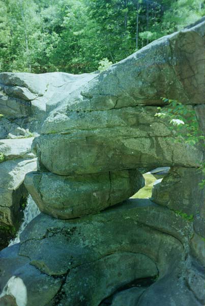
Instead, I photograph the rocks and talk to three groups of people about my trip, a retired airline pilot, some park workers, one of whose wives had crossed the US by bike, and a couple, who had been bicycling in one of the local communities. Although the trip up here has not seemed special, I must admit that this is a very nice stopping point. The attraction is the way the water has molded the rocks, and while far from spectacular, it is nice.
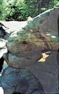
I also stop to visit Moose "Cave," a crack in the rocks that a moose fell into. The "cave" actually has a roof of rock, but it's just the way the rocks fell. However, the deep crack is reminiscent of a cave, not just a ditch.
I also pass the Appalachian Trail for the last time.
At this point I expect to head downhill to the next town; however, I've got lots more uphill to do. So the distance and the time crawl while I get hungry. While traveling through a relatively flat area, I hear and then see a black female moose who has been startled by me and is heading away. Very much of the woods is what I call moose soup: the spongy, lichen-covered ground mashed into a black liquid that does not drain.
Coming down the hill to Umbragog Lake, I see one of the prettiest vistas I've seen anywhere. Of course, it helps that the sky has been crystal clear all day. The lake in the valley below seems to wind around like some huge flooded river with the mountains all around. I don't take a picture because the camera lens is not wide enough and because -- if I did -- the people who live here have cluttered up the view. (800 X 526 Not the view mentioned, but very nice anyway.)
When I stop at Umbragog Lake at five, I recognize that I'm running out of energy. I could go back a short distance to the state park, which would give me water without food and make me pay to camp. I could filter water here, but the wind is creating a lot of turbulence to clog up my filters. I should try to camp as soon as possible, but how can I camp without water and therefore without a way to cook the rice? And I could go on to the next town, but will the store still be open? -- after all, it is six o'clock local time, and I have another seven miles to travel which most definitely will include uphill travel.
As probably the worst choice, I choose to travel onwards towards the store. The route includes more uphills and less opportunities for water than I thought. I have covered half of the distance when I find a party of people around a fire in their yard, and they are kind enough to give me water and information in exchange for a friendly chat. One holds a Rottweiler a few feet away from me the whole time. They tell me that the store in Errol stays open until ten and that it's all downhill from here.
Well, there is one terrific downgrade between their house and the store, but the rest is uphill. The store closes at nine, and I have made it by minutes, so I go in and buy lots of carbohydrates. However, I see after I get back outside that she's in no hurry to close. Before leaving town, I see another business open where I could have gotten some food.
After leaving Errol, the route is definitely not downhill as I'm averaging just ten or eleven miles per hour. I'm in open countryside with patches of woods and many houses. When I see a section of woods, it is near a house. After some miles, I finally see a quarter mile of woods or more with no house nearby. I squeeze between the small spruce trees to find older trees back in and mats of lichen and moss on the ground. I pitch my tent with the mosquitoes not bothering me much because I still have on my tights and raincoat. Then I get in, type for a while, and fall asleep.
Lynchville - Errol, 66 miles, 9.6 mph, July 5, 2000.
Day 36: I awake very early on a cold morning. I had put on my thermal underwear the night before to help with the cold, so I leave them on under my clothes.
Often on the roadway, I see muddy moose tracks, so I stop at one place and hike into the woods on the moose trails, but I see nothing. It is a pleasant stop, though.
I now travel on to the Dixville Notch Park. The first picnic ground is behind the maintenance barn and, as an attraction, has the graves of the people who lived here and a plaque telling how rough their lives were. The second has a stream flowing in a crack which is less than impressive. I then ride past a resort with lots of fancy towers, obviously an expensive joint, and continue on to Colebrook.
Colebrook is fair-sized, so I check about email and making a fax, and make several phone calls which lead to nothing. My problem is that I have learned I must sign a legal document and send it to the attorneys, but they say the document can't be faxed to me. I could have easily signed the paper before leaving Alabama or while at my sister's house in New Jersey, but how can I get mail while traveling by bike? Of course, it would have to be sent to a post office, but how can I give them exact instructions for mailing it to me in Quebec? And how do I know how far I will travel or if the post office will be open that day? (Post offices in small towns keep limited hours, and Canadian holidays are different.) I do get my clothes washed, but I am there until noon without having covered a lot of mileage for the day, mainly due to the phone calls.
It's not a long or hard ride then to the border, but again it's not downhill. However, at the border, I find myself pulled to one side. The woman (the only one there) asks me, "Do you have a gun?" I reply "no." "Where are you from?" "Alabama." "You are from Alabama, and you don't have a gun?" I laugh and say, "Everyone in Alabama has a gun, but I don't have one and have never owned one." "Weren't you in Vietnam?" "No, . . ." But nothing else I say matters. I have to give her my driver's license, so they can run a background check, and I have to show her what is in my bags. I am pleased to note that she stopped two other vehicles at this quiet station within the half hour I am there. The one car is a little bit beat-up and seedy looking, plus it's a sports car driven by a single young man, and the other car, which is much nicer, is driven by a couple who don't speak English or French.
Then it's over hill and dale to Coaticook, a distance of nearly twenty miles, the terrain a mixture of farmlands and small woods. Everything looks absolute gorgeous here, from the grass green fields nearby to the spruce green woods farther away, probably due to the fresh clean, dry air from the north (359X800 Across the Canadian border).
In town, I head for the information office, following the sign, but stop at a bank, where I get to practice French and where changing some money takes forever because the teller is new at this task. Nowadays, it's mainly a problem with the commands on the computer program. I don't think I have received the best exchange rate, but I won't know until I compare [the exchange rate was fine for the traveler's checks but terrible for the cash]. They do ask me if I have an account at the bank.
Leaving the bank, I follow the information trail further, but stop to get something to eat. There, the person helping me shifts from French to English as soon as I reply in French, just as the border guard did. I didn't know my "bonjour" was that poor.
After eating, I decide to abandon the search for information and head back out to my road, going past the bank along the way. But here I get totally lost. There are signs for the other two roads, but none for the route I want to take. After checking many intersections, I finally find one sign (without a route number) that says the town I'm going to is in the direction of the information office. So I had backtracked and wasted half an hour for nothing. Still, to be sure, I stop at a gas station and explain my problem in French and get the answer in English. I don't actually see a route sign until I'm well out of town.
Now comes the problem of where to spend the night. I am in countryside, not woodlands now. I have already figured out that "defense de paser" means "no trespassing" but I'm not sure of local customs and laws. It will be dark before I get to Sherbrooke, so I stop at a campground and pay $17.25 to pitch my tent. It seems a terrible overcharge to me, as I have no RV or family, will not use the electricity, the water, the pool, the roads, or the showers, just the john (I can't use the shower because I carry no towels to dry off and it's quite cold). I don't even take up a camping space. Day users pay just $3.00.
I talk to one couple in both French and English. They think it's OK that Quebeckers should learn English, but they can't understand why English-speaking Canadians aren't required to learn French.
The voltage from my nicads is back up. I guess I'm still getting plenty of sunlight. I might have been having problems due to the laptop's battery running down (back in Connecticut) and thus the laptop was demanding extra juice.
Errol - Compton, Quebec, 55.5 miles, 10.6 mph, July 6, 2000.
|